Reading Time: 2 minutes

Microsoft just doesn’t play around. They’re back with another absolutely massive update, this one totaling around 27TB! I love the amount of 3D they continue to push out. It’s slightly lower quality than Google Earth, but the sheer volume of it more than compensates.
Much of the new imagery is for cities that have new 3D data. This makes sense. 3D buildings tend to look way out of place when they’re on top of low-res imagery.
The good stuff:
New 3D Cities
- Redding, CA
- Colorado Springs, CO
- Fort Collins, CO
- Des Moines, IA
- Sioux City, IA
- Waterloo, IA
- Boise City, ID
- Decatur, IL
- Ann Arbor, MI
- Dearborn, MI
- Flint, MI
- Kalamazoo, MI
- Lansing, MI
- Lincoln, NE
- Omaha, NE
- Reno, NV
- Ogden, UT
- Bellingham, WA
- Kenosha-Racine, WI
Ortho Aerial Imagery
- Ann Arbor, MI
- Bellingham, WA
- Boise City, ID
- Colorado Springs, CO
- Decatur, IL
- Des Moines, IA
- Flint, MI
- Fort Collins, CO
- Kalamazoo, MI
- Kenosha-Racine, WI
- Lansing, MI
- Lincoln, NE
- Omaha, NE
- Redding, CA
- Reno, NV
- Sioux City, IA
- Waterloo, IA
Also, Japan now has level 19 tiles — it previously only went to 18.
Oblique Aerial Imaery
- USA
- Dekalb, AL
- Fayette, AL
- Lamar, AL
- Madison, AL
- Marion, AL
- Marshall, AL
- Morgan, AL
- Walker, AL
- Winston, AL
- Barrow, GA
- Gwinnett, GA
- Newton, GA
- Ada, ID
- Madison, IL
- Delaware, IN
- Lake, IN
- Sedgwich, KS
- Anoka, MN
- St Louis, MN
- Amite, MS
- Covington, MS
- Itawamba, MS
- Jones, MS
- Lee, MS
- Marshall, MS
- Newton, MS
- Prentiss, MS
- Rankin, MS
- Wayne, MS
- Cabarrus, NC
- Gaston, NC
- Lake, OH
- Trumbull, OH
- Bucks, PA
- Delaware, PA
- Luzerne, PA
- Kanawha, WV
- Alachua, FL
- Pinellas, FL
- Volusia, FL
- Brazoria, TX
- Hood, TX
- Jasper, TX
- Jefferson, TX
- Montgomery, TX
- Webb, TX
- Wise, TX
- Europe
- Genk, Belgium
- Bad Salzuflen, Germany
- Geissen, Germany
- Greifswald, Germany
- Neubrandenburg, Germany
- Neunkirchen, Germany
- Odense, Denmark
- Algeciras, Spain
- Aviles, Spain
- Cadiz, Spain
- Cartagena, Spain
- Granollers, Spain
- Irun, Spain
- Oviedo, Spain
- Sagunto, Spain
- Tarragona, Spain
- Jyvaskyla, Finland
- Delft, Netherlands
- Terneuzen, Netherlands
- Olbia, Italy
- Biella, Italy
- Boras, Sweden
- Eskilstuna, Sweden
- Falun, Sweden
- Gavle, Sweden
- Jonkoping, Sweden
- Kalmar, Sweden
- Karlstad, Sweden
- Vasteras, Sweden
- Vaxjo, Sweden
Satellite Imagery
- Ibadan, Nigeria
- Karachi, Pakistan
- Lahore, Pakistan
- Seville, Spain
- Tehran, Iran
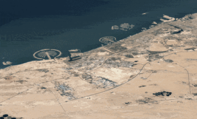
- Dubai, UAE
- Erode, India
- Kannur (Cannanore), India
- Lakshadweep, India
- Chengdu, China
- Kenming, China
- Changsha, China
- Chongqing, China
- Qingdao, China
- Shanghai, China
- Salvador, Brazil
- SaoPaulo, Brazil
- Medellin, Colombia
- Winnipeg, Canada
Insanely awesome.
I am wondering about the basis for your statement that the Microsoft data is lower quality than Google’s. To be sure the Google DigitalGlobe satellite data is higher resolution than Microsoft’s satellite data, but Microsoft’s aerial imagery is much higher resolution than satellite imagery. If you are talking about the 3D models, Microsoft’s are generated through automated photogrammetric processing techniques that produce models of submeter accuracies. Googles are aggregated from its user community, hardly a means of providing reliable data.
I was referring to the 3D models. Personally, I prefer the approach that MS is taking, as it makes cities really come to life. However, on a model-by-model comparison, the Google models tend to look a little better.